Hāna
Place: Hāna, Maui
Type: District / town / cultural landscape
Story it tells: A rain-soaked district on East Maui shaped by isolation, agriculture, powerful chiefs, and enduring Hawaiian cultural identity.
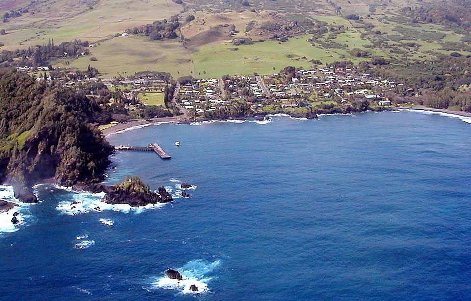
Hāna is a historic district and town on the isolated eastern coast of Maui known for its rainfall, agriculture, and cultural continuity. The name is often translated as “work,” “labor,” or “craft,” reflecting Hāna’s longstanding role as a productive center of farming, fishing, and settlement. Hawaiian traditions describe the area poetically as Hāna i ka ua lani haʻahaʻa (“Hāna of the low-lying rain”), referring to the mist and rain that frequently provide for the people.
For centuries, Hāna was one of the most important regions on Maui. The district became associated with powerful chiefs including Piʻilani and Kahekili, while nearby Kaʻuiki Hill served as a strategic fortress overlooking Hāna Bay. Oral traditions and historical accounts describe battles for control of East Maui, reflecting the political importance of Hāna within the Hawaiian Islands.
Hāna also became tied to larger efforts to unify Maui politically and physically. In the 16th century, Piʻilani’s rule helped establish an era of relative peace and prosperity across the island. Ancient trails and pathways connecting East Maui later evolved into portions of the modern Hāna Highway, the winding road that eventually connected the isolated district to the rest of Maui.
During the plantation era, sugar cultivation expanded into the region, though Hāna remained more isolated and rural than many other parts of Hawaiʻi. Tourism gradually increased during the 20th century, particularly after completion of the Hāna Highway, yet the district retained much of its quieter identity. Today, Hāna is still associated with rainfall, rugged coastline, taro fields, black sand beaches, and a slower pace.